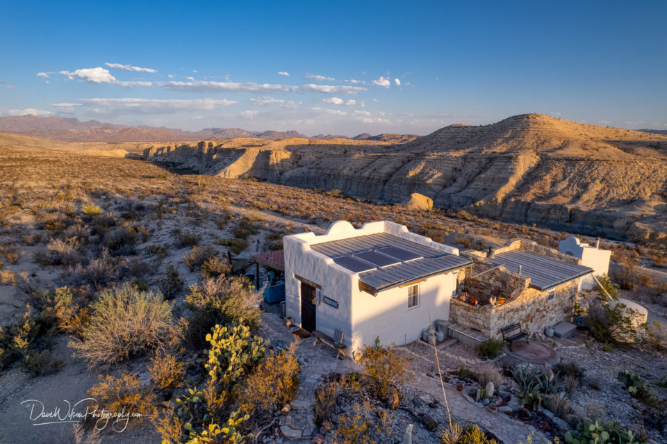
On this trip to Big Bend, we based ourselves in Terlingua and stayed in the same idyllic guest house we found last year. The Leapin’ Lizard is a lovely...
Spires of an ocotillo plant seen silhouetted against the layered landscape of Big Bend National Park on the morning of April 29th, 2022.

A view of the Milky Way behind the adobe outhouse of The Leapin’ Lizard Guest House in Terlingua, Texas. I took this on the night of April 30th at 4:30am....

I’m sure there will be an onslaught of robotics competition pictures over the next week so, just to break things up a bit, I’m revisting a trip...

Continuing this short series of pictures taken beneath the ramparts of Fort Pickens, here’s another shot of one of the more open sections of the outer...

Fort Pickens near Pensacola Beach, Florida, exhibits several contrasting building styles, two of which can be seen in this shot taken in the undercroft...

A view through a group of brickwork arches in the undercroft of Fort Pickens near Pensacola Beach, Florida.

An adobe home near Taos, New Mexico seen in front of the snow-clad Sangre de Christo mountains on December 26th, 2021.

I found this small church during an afternoon of wandering backroads near Taos, New Mexico last December.

An aerial view of a section of Goblin Valley State Park near Hanksville, Utah, taken around sunrise on the morning of November 6th, 2021.

Hopefully today’s image will provide a bit more context after yesterday’s abstract. This is a wider view of the evaporation ponds at Intrepid...

Having taken an exciting, if somewhat hair-raising, 4×4 drive down Shafer Canyon Road in Canyonlands National Park, Utah, last November, we eventually...

Well, I lasted 4 days before heading back into my pictures from the last NxNW trip. This is one of the images taken on our first morning in Utah when we visited...

Yesterday’s image was taken in a canyon 30 feet wide and probably 400 feet deep. Today’s was taken about 100 yards downstream in the same canyon...

An almost-abstract picture taken in a slot canyon near Hanksville, Utah during last November’s NxNW photography group trip to the area. This is a monochrome,...

A collection of hoodoos, precariously-stacked spires of eroded rocks, seen at Goblin Valley State Park, Utah.

The erosion patterns formed by rain in Goblin Valley State Park near Hanksville, Utah, are fascinating. This straight-down drone shot shows one of the many...

A group of the eroded hoodoos at Goblin Valley State Park, Utah seen around sunrise on November 6th, 2021.

An abstract, aerial image taken at Goblin Valley State Park near Hanksville, Utah. The white circular object just left of centre is actually a conical...

I’ve posted some abstracts and detail shots from Goblin Valley State Park but here’s a wide angle drone shot that gives a better idea of the general...
