This was probably the most surreal of the locations we visited last year during our October NxNW trip to Utah. A circular bowl in the grey mesas outside...

I don’t normally post images with odd aspect ratios but I’m making an exception today for this shot of Factory Butte near Hanksville, Utah....

Another favourite location that we revisited during our October NxNW trip to Utah was Moonscape Overlook (also known as Skyline View) near Hanksville....

Another highlight of this October’s NxNW trip to Utah was our return to Marlboro Point, an amazing canyon lands overlook offering fantastic sunrise...

An aerial view of downtown Atlanta, Georgia with Interstate Highway 85 in the foreground. This image was taken on November 25th, 2022.

An aerial image of the buildings of midtown Atlanta, Georgia with one of the signs from the famous Biltmore Hotel in the foreground.
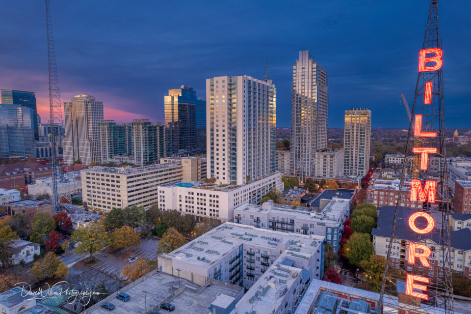
While in Atlanta last week, I took the drone up for a spin above a couple of vacant parking lots in the midtown area and shot some pictures of the skyline...

Eroded ridges leading to the base of Factory Butte near Hanksville, Utah. This drone image was taken just after sunset on October 6th, 2022.

Most of the area around Factory Butte is defined by sharp ridges radiating out from the elevated butte. On the southern side, however, this smoother area...

It wasn’t all rock, sand and desert landscapes during our Utah trip. On one day, we took a drive towards the town of Boulder and found some gorgeous...

An abstract aerial image of curves created by sunlight hiting sand dunes. This image was taken near Hanksville, Utah on October 7th, 2022.

This abstract image was created by pointing my drone camera directly downwards while flying over the eroded terrain near the Mars Desert Research Center...

An overhead image of an eroded ridge near Factory Butte in Utah, taken just before sunset as the light was just catching the top of the ridgeline.

Factory Butte is a very prominent and dramatic feature near Hanksville, Utah. We spent yesterday’s sunrise there and were rewarded with some lovely...

This is the last of the Austin downtown aerial images for now. This is a view of the western portion of downtown Austin with Google’s office buildings...

An aerial view looking north along Congress Avenue from Lady Bird Lake towards the Texas State Capitol in Austin.

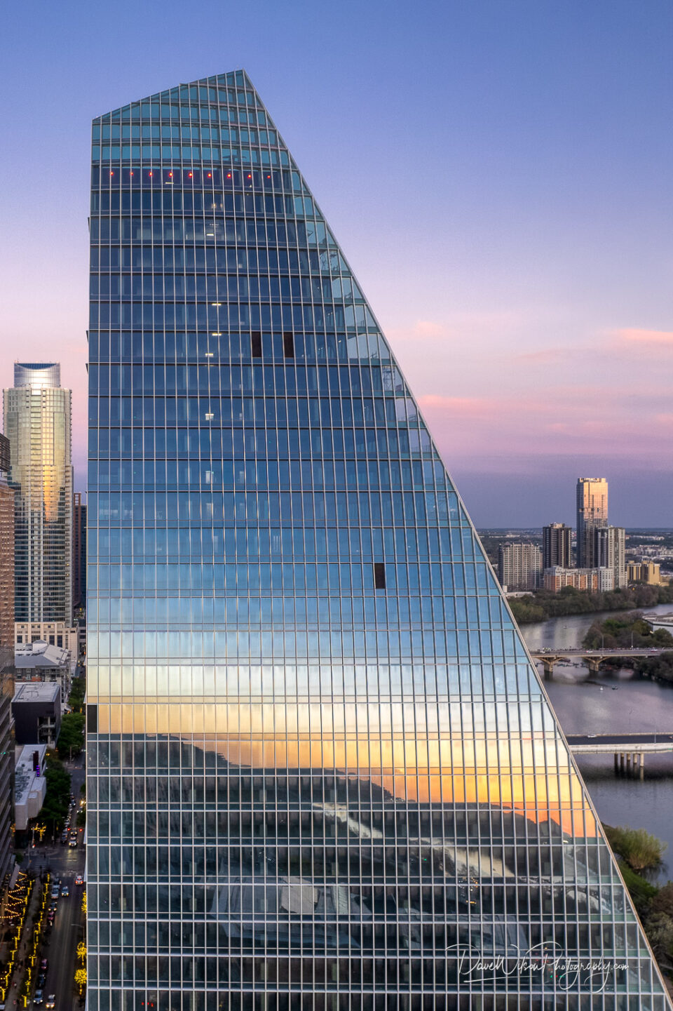
Google’s new downtown Austin, Texas office building, colloquially known as “The Sail”, reflects the sunset on an evening in April 2022.
An aerial view looking north over part of downtown Austin from above the point where Shoal Creek joins Lady Bird Lake.

An aerial view of downtown Austin, Texas with the Lamar railway bridge and Lady Bird Lake in the foreground. This shot was taken in April 2022.

A view of a section of Cesar Chavez Boulevard (or 1st St.) in downtown Austin with City Hall on the right and the new Google building on the left.
